
|
| You might also like: | Canada | Outline Map Canada | Canada's Geography | Today's featured page: The Gingerbread Man |
| Outline Map of Ontario, Canada | Canada More Outline Maps |
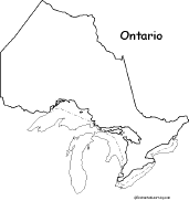
This is a thumbnail of the "Printable Outline Map of Ontario, Canada" page. The full-size printout is available only to site members.
To subscribe to Enchanted Learning, click here.
If you are already a site member, click here.
Related Pages: Flag of Ontario, Canada Print out and color the flag of Ontario, Canada. |
 Canada: Geography, etc. Find information on Canada, including maps, flags, animals, explorers, fossils, art, quizzes, and books to print out. |
Canada: Zoom School Use a pictorial interface to get information on Canada, including maps, animals, explorers, fossils, a quiz, and printouts on Canada. Canada is a large country in North America. |
 Canadian Provinces/Territories: Label Me! Printout Label Canada's 13 provinces and territories. |
 Canada: Outline Map Printout An outline map of Canada to print. |
 Flag of Canada (North America) A page on the Canadian flag plus a quiz and coloring printout. |
Flags of Canadian Provinces (North America) A page on the flags of the Canadian provinces. |
 Canadian Province/Territory Report Graphic Organizer Printout #1 This printout helps the student do a short report on a Canadian Province/Territory, prompting the student to draw a map of the province, locate it on a world map, draw the province's flag, and write its capital city, largest city, area, population, date of admittance to confederation, and provincial flower. |
 Canadian Province/Territory Report Graphic Organizer Printout #2 This printout helps the student do a short report on a Canadian Province/Territory, prompting the student to draw a map of the province, locate it on a world map, draw the province's flag, and write its capital city, largest city, area, population, highest point, date of admittance to confederation, provincial flower, climate, and major industries. |
 Explorers of Canada Read about the people who explored Canada, including Jacques Cartier, Samuel de Champlain, Pierre François-Xavier de Charlevoix, Robert La Salle, Simon Fraser, Louis Joliet, Pierre de La Vérendrye, Alexander Mackenzie, and others. |
 North America: Label Me! Printout Label the countries of North America. Answers |
 North America: Outline Map Printout An outline map of North America to print. |
 Canadian Animals Printable Book for Early Readers A short, printable book about Canadian animal early readers. The book has pages on the moose, cougar, loon, Canada goose, muskrat, Arctic Fox, Arctic hare, caribou, polar bear, and beaver. |
 Where I Live (Canada and USA) A short activity book on geography to print for early readers. There are pages on the Solar System, the continents, North America, and Canada or the USA. |
 Canadian Crafts Make Canadian crafts for Canada Day (on July 1st) or any day. |
 Canadian Fossils Dinosaurs and other fossils found in Canada. |
| Search the Enchanted Learning website for: |