
|
| Our subscribers' grade-level estimate for this page: 3rd - 4th |
 Outline Maps |
EnchantedLearning.com World Geography |
 Flags |
| Africa | Antarctica | Asia | Australia/Oceania | Central America/ Caribbean | Europe | Mideast | North America | South America | USA |
| A | B | C | D | E | F | G | H | I | J | K | L | M | N | O | P | Q | R | S | T | U | V | W | X | Y | Z |
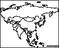
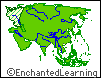
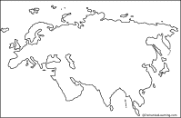
Asia: Outline Map Printout An outline map of Asia to print. |
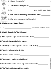 Asia: Quiz A Worksheet to Print A short, printable worksheet quiz about Asia. The short-answer worksheet asks general questions about Asia, for example, "Tokyo is the capital of ______." Select the answers from a word bank. Or go to the answers. |
 Rivers of Asia: Outline Map Printout An outline map of Asia's rivers to print. |
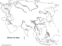 Rivers of Asia: Outline Map Printout A labeled outline map of Asia's rivers to print (rivers are labeled). |
 Asia: Label Me! Printout Label the map of Asia. Answers |
 Asian Flags |
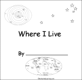 Where I Live (Asia) A short activity book on geography to print for early readers. There are pages on the Solar System, the continents, Asia, and the student's home. |
 Asian Country Report Graphic Organizer Printout #1 This printout helps the student do a short report on an Asian country, prompting the student to draw a map of the country, locate it on a map of Asia, draw the country's flag, and write the country's continent, capital city, area, population, name of currency, and language(s). |
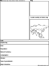 Asian Country Report Graphic Organizer Printout #2 This printout helps the student do a short report on an Asian country, prompting the student to draw a map of the country, locate it on a map of Asia, draw the country's flag, and write the country's continent, capital city, area, population, name of currency, language(s), climate, type of government, and major industries. |
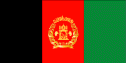 All About Afghanistan Information on Afghanistan, a small, landlocked country in Southwestern Asia (in the Middle East). Do worksheets on the map and the flag of Afghanistan. |
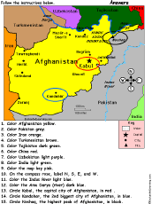 Afghanistan: Follow the Instructions Color Afghanistan according to simple directions, such as, "Color the Indus River light blue." Or go to the answers. |
 Afghanistan: Outline Map Printout An outline map of Afghanistan to print. Or go to printable activities that require research (using an atlas or other geography reference): a simple map research activity, a medium-level map research activity, or an advanced map research activity. |
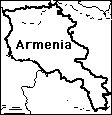 Armenia: Outline Map Printout An outline map of Armenia to print. Or go to printable activities that require research (using an atlas or other geography reference): a simple map research activity, a medium-level map research activity, or an advanced map research activity. |
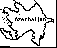 Azerbaijan: Outline Map Printout An outline map of Azerbaijan to print. Or go to printable activities that require research (using an atlas or other geography reference): a simple map research activity, a medium-level map research activity, or an advanced map research activity. |
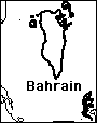 Bahrain: Outline Map Printout An outline map of Bahrain to print. |
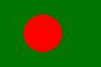 All About Bangladesh Information on Bangladesh, a small, landlocked country in southern Asia. Do worksheets on the map and the flag of Bangladesh. |
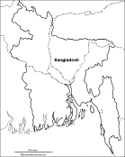 Bangladesh: Outline Map Printout An outline map of Bangladesh to print. Or go to printable activities that require research (using an atlas or other geography reference): a simple map research activity, a medium-level map research activity, or an advanced map research activity. |
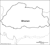 Bhutan: Outline Map Printout An outline map of Bhutan to print. Or go to printable activities that require research (using an atlas or other geography reference): a simple map research activity, a medium-level map research activity, or an advanced map research activity. |
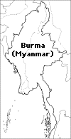 Burma/Myanmar: Outline Map Printout An outline map of Burma/Myanmar to print. |
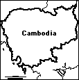 Cambodia: Outline Map Printout An outline map of Cambodia to print. Or go to printable activities that require research (using an atlas or other geography reference): a simple map research activity, a medium-level map research activity, or an advanced map research activity. |
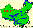
 China Information on China, including maps, flags, crafts, the Great Wall, Chinese New Year, etc. |
 China: Outline Map Printout An outline map of China to print. Or go to printable activities that require research (using an atlas or other geography reference): a simple map research activity, a medium-level map research activity, or an advanced map research activity. |
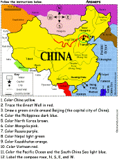 China: Follow the Instructions Color China according to simple directions, such as, "Trace the Great Wall in red." Or go to the answers. |
 Rivers of China: Outline Map Printout An outline map of China's rivers to print. |
 China: Zoom School Use a pictorial interface to get information on China, including maps, flags, printouts, and a quiz. |
 China: Dot to Dot Mystery Map Connect the dots to draw the borders of a mystery country. Then use a globe or atlas to figure out which country you have drawn. You might want to give students clues, such as the continent the country is in (Asia), that it is in the Northern Hemisphere, or that its name starts with "C." Answer: China. |
 China: Map Quiz Printout You can print out a map of China, color it, and take a short quiz on the geography of China. Or go to the answers. |
China: Shape Poem  Write a poem about China inside the map. Or go to a pdf of the poem worksheet. |
China: Perimeter Poem 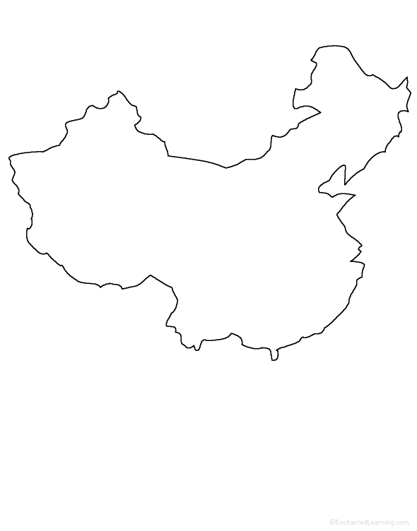 Write a poem around the perimeter (outer edges) of the map. Or go to a pdf of the poem worksheet. |
Great Wall of China Information on the Great Wall of China. |
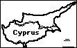 Cyprus: Outline Map Printout An outline map of Cyprus to print. |
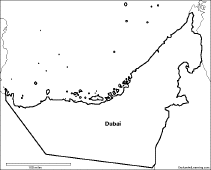 Dubai: Outline Map Printout An outline map of Dubai to print. |
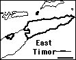 East Timor: Outline Map Printout An outline map of East Timor to print. |
 Eurasia: Outline Map Printout An outline map of Eurasia to print (no country markings). |
 India Information and activities on India to print. |
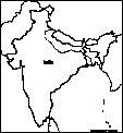
 India: Label Me! Printout Label the map of India. Answers |
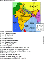 India: Follow the Instructions Color India according to simple directions, such as, "Trace the path of the Ganges River in blue." Or go to the answers. |
 India: Map Quiz Worksheet A printable quiz on the major geographic features of India. The student reads a map to answer 10 geography questions. Or go to the answers. |
 India: Outline Map Printout An outline map of India to print. Or go to printable activities that require research (using an atlas or other geography reference): a simple map research activity, a medium-level map research activity, or an advanced map research activity. |
 India: Dot to Dot Mystery Map Connect the dots to draw the borders of a mystery country. Then use a globe or atlas to figure out which country you have drawn. You might want to give students clues, such as the continent the country is in (Asia), that it is in the Northern Hemisphere, or that its name starts with "I." Answer: India. |
 All About Indonesia Indonesia Information on Indonesia, a country in Southeastern Asia . Do worksheets on the map and the flag of Indonesia. Thursday, January 13, 2011 |
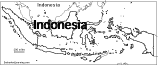 Indonesia: Outline Map Printout An outline map of Indonesia to print. |
Indonesia: Map Quiz Worksheets Go to printable worksheets that require geography research (using an atlas or other geography reference): a simple map research activity, a medium-level map research activity, or an advanced map research activity. |
 All About Iran Information on Iran, a country in the Middle East. Do worksheets on the map and the flag of Iran. |
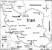 Iran: Map Quiz Worksheet A printable quiz on the major geographic features of Iran. The student reads a map to answer 10 geography questions. Or go to the answers. |
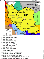 Iran: Follow the Instructions Color Iran according to simple directions, such as, "Color Iran yellow." Or go to the answers. |
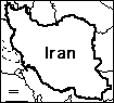 Iran: Outline Map Printout An outline map of Iran to print. Or go to printable activities that require research (using an atlas or other geography reference): a simple map research activity, a medium-level map research activity, or an advanced map research activity. |
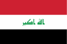 All About Iraq Information on Iraq, a country in Southwestern Asia (in the Middle East). Do worksheets on the map and the flag of Iraq. |
 Iraq: Follow the Instructions Color Iraq according to simple directions, such as, "Trace the paths of the Tigris and Euphrates Rivers in deep blue." Or go to the answers. |
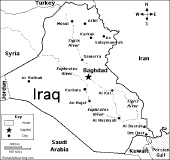 Iraq: Map Quiz Worksheet A printable quiz on the major geographic features of Iraq. The student reads a map to answer 10 geography questions. Or go to the answers. |
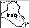 Iraq: Outline Map Printout An outline map of Iraq to print. Or go to printable activities that require research (using an atlas or other geography reference): a simple map research activity, a medium-level map research activity, or an advanced map research activity. |
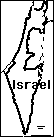 Israel: Outline Map Printout An outline map of Israel to print. Or go to printable activities that require research (using an atlas or other geography reference): a simple map research activity, a medium-level map research activity, or an advanced map research activity. |
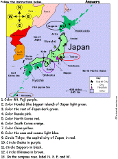 Japan: Follow the Instructions Color Japan according to simple directions, such as, "Color Mt. Fuji purple." Or go to the answers. |
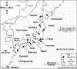
 Japan: Label Me! Printout Label the map of Japan. Answers |
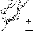 Japan: Outline Map Printout An outline map of Japan to print. Or go to printable activities that require research (using an atlas or other geography reference): a simple map research activity, a medium-level map research activity, or an advanced map research activity. |
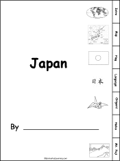 Japan: Printable Book A book about Japan for fluent readers with pages on the map, flag, language, origami, haiku, and Mt. Fuji. |
 Japan: Zoom School Use a pictorial interface to get information on Japan, a country in Asia known for its art, poetry, samurai, and engineering. |
 Japan: Map Quiz Worksheet A printable quiz on the major geographic features of Japan. The student reads a map to answer 10 geography questions. Or go to the answers. |
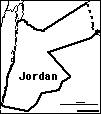 Jordan: Outline Map Printout An outline map of Jordan to print. |
 Kazakhstan: Outline Map Printout An outline map of Kazakhstan to print. |
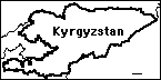 Kyrgyzstan: Outline Map Printout An outline map of Kyrgyzstan to print. |
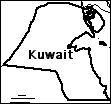 Kuwait: Outline Map Printout An outline map of Kuwait to print. |
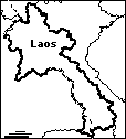 Laos: Outline Map Printout An outline map of Laos to print. |
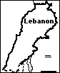 Lebanon: Outline Map Printout An outline map of Lebanon to print. |
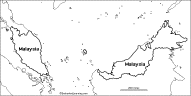 Malaysia: Outline Map Printout An outline map of Malaysia to print. Or go to printable worksheets that require research (using an atlas or other geography reference): a simple map research activity, a medium-level map research activity, or an advanced map research activity. |
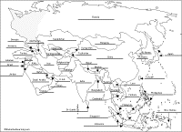
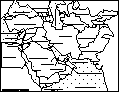 Middle East Map: Label Me! Printout Label a map of the Middle East. Answers |
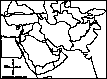 Middle East: Outline Map Printout An outline map of the Middle East to print. |
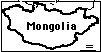 Mongolia: Outline Map Printout An outline map of Mongolia to print. |
Myanmar/Burma: Outline Map Printout An outline map of Burma/Myanmar to print. |
 Nepal: Outline Map Printout An outline map of Nepal to print. |
 North Korea: Outline Map Printout An outline map of North Korea to print. |
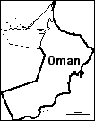 Oman: Outline Map Printout An outline map of Oman to print. Or go to printable activities that require research (using an atlas or other geography reference): a simple map research activity, a medium-level map research activity, or an advanced map research activity. |
 All About Pakistan Information on Pakistan, a country in Southwestern Asia (in the Middle East). Do worksheets on the map and the flag of Pakistan. |
 Pakistan: Follow the Instructions Color Pakistan according to simple directions, such as, "Color Pakistan yellow." Or go to the answers. |
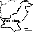 Pakistan: Outline Map Printout An outline map of Pakistan to print. Or go to printable worksheets that require research (using an atlas or other geography reference): a simple map research activity, a medium-level map research activity, or an advanced map research activity. |
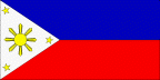 All About Philippines Information on Philippines, a country in Southeastern Asia. Do worksheets on the map and the flag of Philippines. |
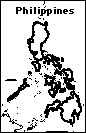 Philippines: Outline Map Printout An outline map of the Philippines to print. |
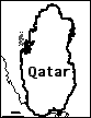 Qatar: Outline Map Printout An outline map of Qatar to print. |
 All About Russia Information on Russia, a huge country in Asia and Europe. Do worksheets on the map and the flag of Russia. |
 Russia: Map Quiz Worksheet A printable quiz on the major geographic features of Russia. The student reads a map to answer 10 geography questions. Or go to the answers. |
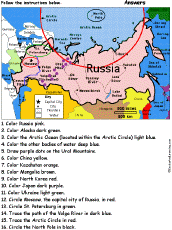 Russia: Follow the Instructions Color Russia according to simple directions, such as, "Trace the Arctic Circle in red." Or go to the answers. |
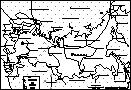 Russia: Label Me! Printout Label the map of Russia. Answers |
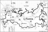
 Russia: Outline Map Printout An outline map of Russia to print (vertical orientation). |
Russia: Outline Map Printout An outline map of Russia to print (a smaller map with horizontal orientation). Or go to printable activities that require research (using an atlas or other geography reference): a simple map research activity, a medium-level map research activity, or an advanced map research activity. |
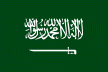 All About Saudi Arabia Information on Saudi Arabia, a country in Southwestern Asia (in the Middle East). Do worksheets on the map and the flag of Saudi Arabia. |
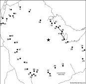
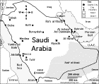 Saudi Arabia: Map Quiz Worksheet A printable quiz on the major geographic features of Saudi Arabia. The student reads a map to answer 10 geography questions. Or go to the answers. |
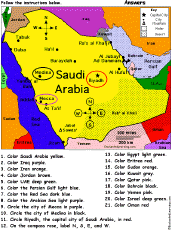 Saudi Arabia: Follow the Instructions Draw and color Saudi Arabia according to simple directions, such as, "Color the Persian Gulf light blue." Or go to the answers. |
 Saudi Arabia: Outline Map Printout An outline map of Saudi Arabia to print. Or go to printable activities that require research (using an atlas or other geography reference): a simple map research activity, a medium-level map research activity, or an advanced map research activity. |
 Saudi Arabia: Dot to Dot Mystery Map Connect the dots to draw the borders of a mystery country. Then use a globe or atlas to figure out which country you have drawn. You might want to give students clues, such as the continent the country is in (Asia), that it is in the Middle East, that it is in the Northern Hemisphere, or that its name starts with "S." Answer: Saudi Arabia. |
 Singapore: Outline Map Printout An outline map of Singapore to print. |
 Southeast Asia: Outline Map Printout An outline map of Southeast Asia to print. |
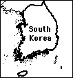 South Korea: Outline Map Printout An outline map of South Korea to print. Or go to printable activities that require research (using an atlas or other geography reference): a simple map research activity, a medium-level map research activity, or an advanced map research activity. |
 South Korea: Label Me! Printout Label the map of South Korea. Answers |
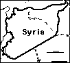 Syria: Outline Map Printout An outline map of Syria to print. Or go to printable activities that require research (using an atlas or other geography reference): a simple map research activity, a medium-level map research activity, or an advanced map research activity. |
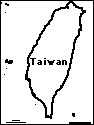 Taiwan: Outline Map Printout An outline map of Taiwan to print. |
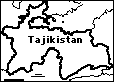 Tajikistan: Outline Map Printout An outline map of Tajikistan to print. |
 Thailand: Outline Map Printout An outline map of Thailand to print. |
 Thailand: Dot to Dot Mystery Map Connect the dots to draw the borders of a mystery country. Then use a globe or atlas to figure out which country you have drawn. You might want to give students clues, such as the continent the country is in (Asia), that it is in the Northern Hemisphere, or that its name starts with "T." Answer: Thailand. |
 All About Turkey Information on Turkey, a country in Asia and Europe. Do worksheets on the map and the flag of Turkey. |
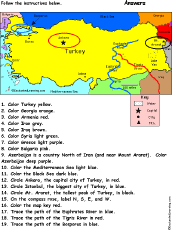 Turkey: Follow the Instructions Color Turkey according to simple directions, such as, "Trace the path of the Bosporus in blue." Or go to the answers. |
 Turkey: Outline Map Printout An outline map of Turkey to print. Or go to printable worksheets that require research (using an atlas or other geography reference): a simple map research activity, a medium-level map research activity, or an advanced map research activity. |
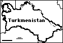 Turkmenistan: Outline Map Printout An outline map of Turkmenistan to print. |
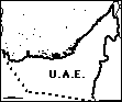 United Arab Emirates: Outline Map Printout An outline map of U.A.E. to print. Or go to printable activities that require research (using an atlas or other geography reference): a simple map research activity, a medium-level map research activity, or an advanced map research activity. |
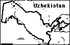 Uzbekistan: Outline Map Printout An outline map of Uzbekistan to print. |
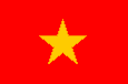 All About Vietnam Information on Vietnam, a small country in Southeastern Asia. Do worksheets on the map and the flag of Vietnam. |
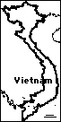 Vietnam: Outline Map Printout An outline map of Vietnam to print. Or go to printable worksheets that require research (using an atlas or other geography reference): a simple map research activity, a medium-level map research activity, or an advanced map research activity. |
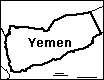 Yemen: Outline Map Printout An outline map of Yemen to print. |
Little Explorers Picture Dictionary:
-English
-English-French
-English-German
-English-Italian
-English-Japanese
-English-Portuguese
-English-Spanish
Enchanted Learning®
Over 35,000 Web Pages
Sample Pages for Prospective Subscribers, or click below
|
Overview of Site What's New Enchanted Learning Home Monthly Activity Calendar Books to Print Site Index K-3 Crafts K-3 Themes Little Explorers Picture dictionary PreK/K Activities Rebus Rhymes Stories Writing Cloze Activities Essay Topics Newspaper Writing Activities Parts of Speech Fiction The Test of Time
|
Biology Animal Printouts Biology Label Printouts Biomes Birds Butterflies Dinosaurs Food Chain Human Anatomy Mammals Plants Rainforests Sharks Whales Physical Sciences: K-12 Astronomy The Earth Geology Hurricanes Landforms Oceans Tsunami Volcano |
Languages Dutch French German Italian Japanese (Romaji) Portuguese Spanish Swedish Geography/History Explorers Flags Geography Inventors US History Other Topics Art and Artists Calendars College Finder Crafts Graphic Organizers Label Me! Printouts Math Music Word Wheels |
Click to read our Privacy Policy
| Search the Enchanted Learning website for: |
Copyright ©2002-2018 EnchantedLearning.com ------ How to cite a web page