Maps
View maps from around the world and complete various map-based activities and worksheets!
Add Filters
Add Filters
Page Types
Activities & Fun
(470)
Crafts
(14)
Printouts
(681)
Quizzes
(258)
Teacher Resources
(52)
Worksheets
(121)
Grade Levels
Work in Progress - Not all pages are categorized yet
Preschool
(0)
Kindergarten
(2)
1st Grade
(27)
2nd Grade
(129)
3rd Grade
(323)
4th Grade
(481)
5th Grade
(306)
6th Grade
(100)
7th Grade and Up
(24)

South Atlantic Map/Quiz Printout.

Missouri: Facts, Map and State Symbols.
Activity for World Latitude and Longitude Outline Map (cylindrical projection). A collection of geography pages, printouts...
★
Full access for members only.
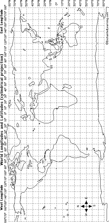
World Latitude and Longitude Outline Map (cylindrical projection). A collection of geography pages, printouts, and...

Montana: Facts, Map and State Symbols.
Nebraska: Facts, Map and State Symbols.
Label Indiana State Map Printout Answers.
★
Full access for members only.
Nevada: Facts, Map and State Symbols.

New Hampshire: Facts, Map and State Symbols.

New Jersey: Facts, Map and State Symbols.
| Previous Page | Page 82 of 136 | Next Page |