Maps
View maps from around the world and complete various map-based activities and worksheets!
Add Filters
Add Filters
Page Types
Activities & Fun
(470)
Crafts
(14)
Printouts
(681)
Quizzes
(258)
Teacher Resources
(52)
Worksheets
(121)
Grade Levels
Work in Progress - Not all pages are categorized yet
Preschool
(0)
Kindergarten
(2)
1st Grade
(27)
2nd Grade
(129)
3rd Grade
(323)
4th Grade
(481)
5th Grade
(306)
6th Grade
(100)
7th Grade and Up
(24)
Illinois State Map/Quiz Answers.
★
Full access for members only.

Illinois State Map/Quiz Printout.

Canada has 10 provinces and 3 territories: Alberta (Edmonton), British Columbia (Victoria), (Fredericton), Nova Scotia...

Canada Map/Quiz Printout. Read the map and answer questions about Canada's geography.
★
Full access for members only.
Indiana State Map/Quiz Answers.
★
Full access for members only.

Canada Map/Quiz Printout. Read the map and answer questions about Canada's geography.
Canada Map/Quiz Printout Answers. Read the map and answer questions about Canada's geography.
★
Full access for members only.

Label Canadian Provinces Map Printout.
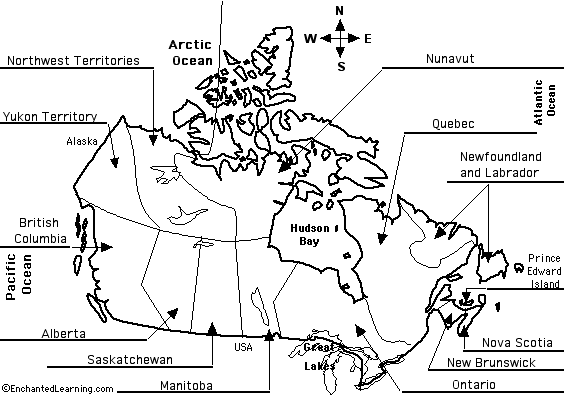
Answers: Label Canadian Provinces Map Printout.
★
Full access for members only.
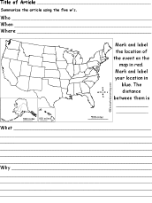
US Map Chart Printout: 5 W's labeled sections around a main oval, labeled, Who, When, What, Where, and Why.
★
Full access for members only.
| Previous Page | Page 91 of 136 | Next Page |