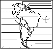
Location: Peru (officially called the Republic of Peru) is a country in western South America. Peru is bordered by Ecuador, Colombia, Brazil, Bolivia, and the Pacific Ocean.
Capital: Lima is the capital of Peru.
Size: Peru covers about 1,285,216 square kilometers (a bit smaller than the US state of Alaska). Peru is the 20th largest country in the world.
Population: The people of Peru are called Peruvians. Peru has the 32nd largest population of any country in the world. The population of Peru is about 41,343,201 (as of July, 2010).
Government: Peru is a republic that is divided into 25 regions. The national holiday is Independence Day, celebrated on July 28. Peru became independent from Spain on July 28, 1821.
Language: The official language is Spanish (spoken by 84.1% of the people). Other languages include Quechua 13% (official), Aymara 1.7%, Ashaninka 0.3%, other native languages 0.7% (includes a large number of minor Amazonian languages), other 0.2%.
Education: Girls in Peru go to school for an average of 14 years; boys go for an average of 13 years.
Literacy Rate: About 92.9% (almost all) of the adults in Peru can read and write. About 96.4% of the men and 89.4% of the women are literate.
Religion: Roman Catholic 92% (less than 20% practicing), Protestant 2%, Jewish 2%, other 4%.
 Flag of Peru : The flag of Peru is composed of three equal, vertical bands of red, white, and red. The coat of arms (designed by José Gregorio Paredes) is in the central band; the coat of arms pictures a shield containing a vicuña (a llama-like animal), a cinchona tree (the national tree of Peru and the source of quinine, an anti-malarial drug), a yellow cornucopia full of gold coins, and a green laurel wreath and branches (with red berries and ribbons). The ratio of its height to its width is 2:3.
This flag was officially adopted on February 25, 1825, soon after Peru obtained independence from Spain.
Climate: Peru varies from tropical in east to dry desert in west; it is temperate to frigid in the Andes Mountains.
Major Rivers: The Ucayali, Marañón, Putumayo, Yavarí, Huallaga, Urubamba, and Mantaro flow through Peru. The Amazon River begins in the Andes Mountains (at the mountain called Nevado Mismi) and flows eastward.
Lake: Lake Titicaca (located on the southeastern border of Peru, extending into Bolivia) is the largest lake (by volume) in South America. It is roughly 190 km (118 mi) by 80 km (50 mi). It is 3,811 m (12,500 ft) above sea level.
Terrain/Mountain Ranges: Western coastal plain (costa), high and rugged Andes Mountains in the center (sierra), eastern lowland jungle in the Amazon River Basin (selva).
Highest Point: The highest point in Peru is Nevado Huascaran, which is 6,768 m above sea level; it is located in central Peru.
Lowest Point: The lowest point in Peru is the Pacific Ocean, at sea level.
Natural Resources: Copper, silver, gold, petroleum, timber, fish, iron ore, coal, phosphate, potash, hydropower, natural gas.
Major Industries: Mining and refining of minerals; steel, metal fabrication; petroleum extraction and refining, natural gas and natural gas liquefaction; fishing and fish processing, cement, textiles, clothing, food processing.
Agricultural Products: Asparagus, coffee, cocoa, cotton, sugarcane, rice, potatoes, corn, plantains, grapes, oranges, pineapples, guavas, bananas, apples, lemons, pears, coca, tomatoes, mango, barley, medicinal plants, palm oil, marigold, onion, wheat, dry beans; poultry, beef, dairy products; fish; guinea pigs.
Related Pages:
Enchanted Learning®
Over 35,000 Web Pages
Sample Pages for Prospective Subscribers, or click below
Click to read our Privacy Policy