
|
| You might also like: | Pakistan | Saudi Arabia | Iraq | Afghanistan | Bangladesh | Today's featured page: Artists Calendar 2025-2026 School Year |
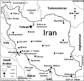
Capital: Tehran is the capital of Iran.
Size: Iran covers about 1,648,195 square kilometers (slightly smaller than the state of Alaska). Iran is the 18th largest country in the world.
Population: The people of Iran are called Iranians. Iran has the 18th largest population of any country in the world. The population of Iran is about 76,923,300 (as of July, 2010).
Government: Iran is a republic that is divided into 31 provinces. The National Holiday is Republic Day, which is celebrated on April 1 (the Islamic Republic of Iran was proclaimed on April 1, 1979).
Language: Persian and Persian dialects 58%, Turkic and Turkic dialects 26%, Kurdish 9%, Luri 2%, Balochi 1%, Arabic 1%, Turkish 1%, other 2%
Education: Girls in Iran go to school for an average of 15 years; boys go for an average of 14 years.
Literacy Rate: About 77% (more than three-quarters) of the adults in Iran can read and write. About 83.5% of the men and 70.4% of the women are literate.
Official Religion: Muslim 98% (Shia 89%, Sunni 9%), other (includes Zoroastrian, Jewish, Christian, and Baha'i) 2%.
Major Rivers: None.
Terrain: Rugged mountains surround the country;. There is a high, central basin with deserts and mountains. Small, discontinuous plains run along both coasts.
Highest Point: The highest point in Iran is Kuh-e Damavand (5,671 m above sea level), located in northern Iraq.
Lowest Point: The lowest point in Iran is the Caspian Sea, at 28 meters above sea level.
Natural Resources: petroleum, natural gas, coal, chromium, copper, iron ore, lead, manganese, zinc, sulfur
Major Industries: petroleum, petrochemicals, fertilizers, caustic soda, textiles, cement and other construction materials, food processing (particularly sugar refining and vegetable oil production), ferrous and non-ferrous metal fabrication, armaments.
Agricultural Products: wheat, rice, other grains, sugar beets, sugar cane, fruits, nuts, cotton; dairy products, wool; caviar.

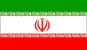
Iran's FlagEnchantedLearning.com
All About Iran
Map/Quiz Printout
Location: Iran (officially called the Islamic Republic of Iran) is a country in southwestern Asia (in the Middle East). Iran is bordered by the Caspian Sea, Turkmenistan, Afghanistan, Pakistan, the Gulf of Oman, the Persian Gulf, Iraq, Turkey, Armenia, and Azerbaijan.

 Iran's Flag: The Iranian flag is a tricolor with three equal horizontal stripes with green on the top, white in the middle, and red on the bottom. In the center of the white stripe is the red national emblem (a stylized representation of the word Allah in the shape of a tulip, a symbol of martyrdom). The words "ALLAH AKBAR" (God is Great) in written in white Arabic script, and repeated 11 times along the bottom edge of the green bottom stripe, and 11 times along the top edge of the red top stripe. The color green symbolizes Islam and growth, white represents honesty and peace, and red stands for bravery and martyrdom.
Climate: Iran's climate is generally dry. The Caspian coast is subtropical.
Related Activities and Printouts:
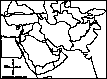
Iran: Outline Map Printout Go to an outline map of Iran to print. |
Iran: Map Quiz Worksheets Go to printable map quiz activities that require research (using an atlas or other geography reference): a simple map research activity, a medium-level map research activity, or an advanced map research activity. |
 Flag of Iran to Color Color a blackline master (printout) of the flag of Iran. |
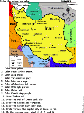 Iran: Follow the Instructions Color Iran according to simple directions, such as, "Color Iran yellow." Or go to the answers. |
 Iran: Map Quiz Worksheet A printable quiz on the major geographic features of Iran. The student reads a map to answer 10 geography questions. Or go to the answers. |
 Asia: Outline Map Printout An outline map of Asia to print. |
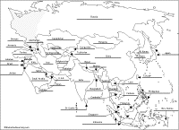 Asia: Label Me! Printout Label the map of Asia. Answers |
 Middle East Geography Pages on the geography of the Mideast. |
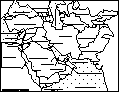 Middle East Map: Label Me! Printout Label a map of the Middle East. Answers |
 Middle East: Outline Map Printout An outline map of the Middle East to print. |
Reference:
CIA World Factbook
Enchanted Learning®
Over 35,000 Web Pages
Sample Pages for Prospective Subscribers, or click below
|
Overview of Site What's New Enchanted Learning Home Monthly Activity Calendar Books to Print Site Index K-3 Crafts K-3 Themes Little Explorers Picture dictionary PreK/K Activities Rebus Rhymes Stories Writing Cloze Activities Essay Topics Newspaper Writing Activities Parts of Speech Fiction The Test of Time
|
Biology Animal Printouts Biology Label Printouts Biomes Birds Butterflies Dinosaurs Food Chain Human Anatomy Mammals Plants Rainforests Sharks Whales Physical Sciences: K-12 Astronomy The Earth Geology Hurricanes Landforms Oceans Tsunami Volcano |
Languages Dutch French German Italian Japanese (Romaji) Portuguese Spanish Swedish Geography/History Explorers Flags Geography Inventors US History Other Topics Art and Artists Calendars College Finder Crafts Graphic Organizers Label Me! Printouts Math Music Word Wheels |
Click to read our Privacy Policy
| Search the Enchanted Learning website for: |